About
Comprehensive Social Sensing for Human-Environment Interactions
The widespread proliferation of information and communication techniques (ICTs) has fostered a plethora of big geo-data characterizing the spatiotemporal information of human activities, behaviors, and interactions. Focusing on human-environment scenarios such as urban socioeconomics, public health, transportation, pollution, sustainability, and ecosystems, we combine spatial thinking and cross-disciplinary methods to facilitate intelligent social sensing, understanding how human activities and behaviors are impacted by socioenvironmental changes and vice versa.

Geospatial Intelligence for Analytics and Modeling
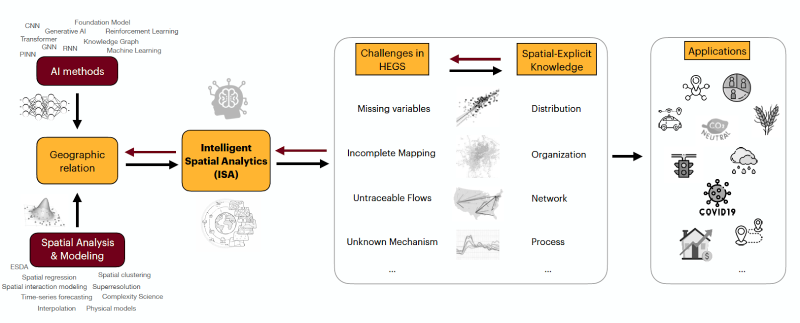
Classic spatial analytics and models are facing great challenges when embracing the explosive growth of geospatial data. Our understanding of geospatial complexities, such as distribution, organization, network, and process, can at the same time benefit from embracing such new data and computation opportunities. GeoDI lab explores how spatially-explicit methods can be enriched with more possibilities, incorporating state-of-the-art machine learning and deep learning principles, boosting intelligent, innovative, and informative geospatial thinking at the frontier of GeoAI.
Geospatial Data Intelligence Lab
473 Social Sciences Building
267 19th Ave S
Minneapolis, MN 55455
Contact Us